220 tracking channels with High Accuracy V30 RTK GPS RTK GNSS
USD $0.1 - $0.2
/ Set
1 Set(Min.Order)
- 100 Set / Sets per Month
- Shanghai
- T/T Credit Card

You May Like
-
 Advanced BD970 Motherboard V30 RTK GPS RTK GNSS RTK Surveying Instruments
-
V90 puls GNSS RTK System for Topographic Surveys
-
Light Weight V90 plus RTK GPS Gnss Navigation
-
GNSS GPS Surveying with High Precision CORS System for Marine survey
-
High resolution mineral drtector DUK-2B Multi-Electrode Resistance meter
-
DZQ6B Engineering Seismograph (Surface Wave Instrument)
Product Details
| Type | Gps Navigator | Use | Automotive | |
| Screen Size | 2.5 inch | Function | Bluetooth-enabled, Mp3/Mp4, Radio Tuner | |
| Place of Origin | Chongqing, China | Brand Name | Hi-Target | |
| Model Number | V30 | Warranty | 12 Months |
Product Description
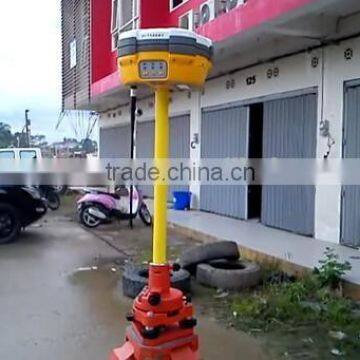
| V30 GNSS RTK system |
Product Description
MEASUREMENTS
• 220 Channels
• Advanced Pacific Crest Maxwell 6 Custom Survey GNSS Technology
• High precision multiple correlator for GNSS pseudo range measurements
• Unfiltered, unsmoothed pseudo range measurements data for low noise, low multipath error, low time domain correlation and high dynamic response
• Very low noise GNSS carrier phase measurements with <1 mm precision in a 1 Hz bandwidth
• Signal-to-Noise ratios reported in dB-Hz
• Proven Pacific Crest low elevation tracking technology
Satellite signals tracked simultaneously
GPS: Simultaneous L1C/A, L2C, L2E, L5
GLONASS: Simultaneous L1C/A, L1P, L2C/A (GLONASS M only), L2P
SBAS: Simultaneous L1 C/A, L5
Galileo: Simultaneous L1 BOC, E5A, E5B, E5AltBOC
BDS: B1, B2
QZSS: L1 C/A, L1 SAIF, L2C, L5
POSITIONING PERFORMANCE
Static and Fast Static GNSS surveying
Horizontal: 2.5mm+0.5ppm RMS
Vertical: 5mm+0.5ppm RMS
Post Processing Kinematic
(PPK / Stop & Go) GNSS surveying
Horizontal: 1cm+1ppm RMS
Vertical: 2.5cm+1ppm RMS
Initialization time: typically 10 minutes for base while 5 minutes for rover
Initialization reliability: typically > 99.9%
RealtimeKinematic(RTK) surveying
Horizontal: 8mm+1ppm RMS
Vertical: 15mm+1ppm RMS
Initialization time: typically < 8 seconds
Initialization reliability: typically > 99.9%
Code Differential GNSS positioning
Horizontal: 25cm+1ppm RMS
Vertical: 50cm+1ppm RMS
SBAS[iv]: 0.50m Horizontal, 0.85m Vertical
HARDWARE
Physical
Dimensions (W x H): 19.50cm x 10.40cm(7.68 in x 4.09 in)
Weight: 1.3kg (2.86lb) with internal battery, internal radio, standard UHF antenna
Operating temperature: -45℃to +65℃ (-49℉ to +149℉)
Storage temperature: -55℃ to +85℃ (-67℉ to +185℉)
Humidity: 100%, considering
Water/dustproof: IP67 dustproof, protected from temporary immersion to depth of 1m (3.28ft).
Shock and Vibration: Designed to survive a 3m(9.84ft) natural fall onto concrete.
Electrical
Power 6V to 28V DC external power input
Power consumption 2.5W
Automatic Switching between internal power and external power
Rechargeable, removable 7.4V, 5000mAh Lithium-Ion battery in internal battery compartment
Internal battery life
Static 13 - 15 hours
RTK Rover (UHF/GPRS/3G) 10 - 12 hours
RTK Base 8 - 10 hours
I/O interface
1 x Bluetooth
1 x standard USB2.0 port
2 x RS232 serial port
2 x DC power input (8-pin & 5-pin)
COMMUNICATION AND DATA STORAGE
GPRS/GSM or 3G
Fully integrated, fully sealed internal GPRS/GSM or 3G
Network RTK (via CORS) range20-50km
HI-TARGET internal UHF radio (standard)
Transmitting Power: 0.1W, 1W, 2W adjustable
Transmitting Speed: Up to 19.2Kbps
Working Range: 3~5Km typical, 8~10km optimal
Pacific Crest XDL micro Internal UHF Radio
Frequency: 403~473 MHz
Transmitting Power: 0.5W, 1.0W, 2.0W adjustable
Transmitting Speed: Up to 19.2Kbps
Support most of radio communication protocol
Working Range: 3~5km typical, 8~10km optimal
HI-TARGET External UHF radio (standard)
Frequency: 460 MHz with 116 channels
Transmitting Power: 5W, 10W, 20W, 30W adjustable
Transmitting Speed: Up to 19.2Kbps
Working Range: 8~10Km typical, 15~20km optimal
Pacific Crest ADL Vantage Pro External UHF radio
Frequency: 390~430 MHz or 430~470 MHz
Transmitting Power: 4W to 35W adjustable
Transmitting Speed: Up to 19.2Kbps
Support most of radio communication protocol
Working Range: 8~10Km typical, 15~20km optimal
Support other external communication device
For example, external GSM modem.
Data storage
64MB internal memory
Data formats
(1Hz positioning output, up to 50 Hz - depends on installed option)
CMR: sCMRx, CMR, CMR+input and output
RTCM: RTCM 2.1, 2.2, 2.3, 3.0, 3.1 input and output
Navigation outputs ASCII: NMEA-0183 GSV, AVR, RMC, HDT, VGK, VHD, ROT, GGK, GGA, GSA, ZDA, VTG, GST, PJT, PJK, BPQ, GLL, GRS, GBS
Navigation outputs Binary: GSOF
1 Pulse Per Second Output
Contact Us
- Chongqing Huobo Surveying Instruments Co., Ltd.
- Contact nameMichelle Li Chat Now
- Phone0086-023-62794421
- AddressNo. 7-8, No. 23, Nanping West Road, Nanping Street
Product Categories
| Drilling Rig | Mapping GIS | New Products | Surveying |
New Products
-
DDC-8 Resistivity Meter for geophysical and mineral exploration
-
DZQ6B Surface Wave Geological Engineering Seismograph
-
Hot sale efficient DZS-1 deep digital seismograph with ISO certificated
-
Geological surveying instrument
-
High resolution research DUK-2B Multi-Electrode Resistivity Survey System
-
Efficient Resistivity Meter for geological prospecting and mineral exploration
-
Efficient CDJ Series Digital Seismic Geophones
-
DZD-6 Water and mineral detector, Multi-Function DC Resistivity & IP Instruments with ISO certificated
-
Geophsical surveying instrument CDJ Series Digital Seismic Geophones
-
Multi-founctional CDJ Series Digital Seismic Geophones
-
High fidelity Oil and Gas detector CDJ Series digital seismic geophones
-
Metal & non-metal detactor DDC-8 electric Resistivity Meter
-
High Accuracy Topographic Survey Engineering Construction GPS Receiver
-
Land Manage and Engineering Construction Design Use RTK GPS
-
High accuracy RTK GPS with WIFI,Bluetooth,USB serial
-
Hi-target GPS Of V30 RTK Surveying equpiment,RTK GPS,RTK GNSS with best navigation
-
High Pressional H32 RTK GPS Made in China
-
Most Classical GPS Receiver Model V30 GNSS System GPS
-
Professional Hi-target V30 GNSS RTK GPS Base and Rover Receiver
-
Hot Sale HI-TARGET Laser Scanner with High Precision
-
Professional Survey Instrument 120 Channel Hi Target GPS
-
GPS Mapping Equipment GNSS RTK Receiver Hi-Target GNSS GPS L1 L2 Surveying Instrument for sale
-
Hi-target V30 GPS GLONSS BDS RECEIVER Topographic Surveys High Accurcay GPS Module
-
Hot Selling GNSS Survey Instruments Hi-Target GNSS Equipment GPS for Land surveyors
Popular Searches
- satellite
- gsm
- gps navigator
- gps navigation box
- gps chipset
- car gps
- box gps car navigation
- vehicle device
- call logger
- gps tracker
- car tracker
- Gps Car Alarm
- Tracking Car Alarm
- gps navigation
- car navigation
- gps navigation system
- Car Gps Tracker
- Gps Tracking System
- Gps Vehicle Tracking System
- Gps Map
- mini antenna satellite
- sim card backup
- car gps navigation
- Navigation & GPS
- gps system
- navigator
- gps device
- portable gps
- Car Navigation Gps
- Tracker Gps
Recommended Products
- Original SMC IP200-120 cylinder positioner New original authentic
- Hi Target GPS V200 GNSS RTK Receiver with tilt sensor
- Hi Target GPS V200 GNSS RTK Receiver with tilt sensor
- 4 Channel HD Mobile DVR 1080P Public Bus Truck Mdvr GPS 3G 4G Mobile DVR
- Full HD HDD 8CH 1080P DVR para vigilancia por vídeo de seguran?a de veículos
- 107M Series (Type A, Type B, Type C, Type D) Double Antenna Combination Micro Inertial Measurement System
- 105M Series (Type A, Type B, Type C, Type D) Single Antenna Combination Micro Inertial Measurement System
- INS1200 Series Fiber Optic GNSS/INS Integrated Inertial Navigation System of Type A, Type B, Type C, and Type D
- INS900 Series Fiber Optic GNSS/INS Integrated Inertial Navigation System of Type A, Type B, Type C, and Type D
- INS600 Series Fiber Optic GNSS/INS Integrated Inertial Navigation System of Type A, Type B, Type C, and Type D
- INS300 Series Fiber Optic GNSS/INS Integrated Inertial Navigation System of Type A, Type B, Type C, and Type D
- FOG900 Series A-type, B-type, C-type, D-type Fiber Optic Gyroscope
Find Similar Products By Category
- Electrical & Electronics > GPS > GPS Navigator
- Please Enter your Email Address
- Please enter the content for your inquiry.
We will find the most reliable suppliers for you according to your description.
Send Now
Chongqing Huobo Surveying Instruments Co., Ltd.
AIBot OnlineThis conversation is AI-generated. Contact manufacturer before transaction to confirm info.
-
 Michelle Li
Welcome to my shop, I'm glad to serve you. Please feel free to send me any questions you may have.
Michelle Li
Welcome to my shop, I'm glad to serve you. Please feel free to send me any questions you may have.
Your message has exceeded the limit.
- Contact supplier for lowest price
- Customized Request
- Request Sample
- Request Free Catalogs
Your message has exceeded the limit.
-
Purchase Quantity
-
*Sourcing Details
Your inquiry content must be between 10 to 5000 characters.
-
*Email
Please enter Your valid email address.
-
Mobile