Home > Products > Surveying > Dual Frequency Geodetic GPS RTK Brand New China HI-Target V60 RTK GNSS Survey
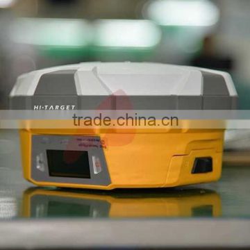


Dual Frequency Geodetic GPS RTK Brand New China HI-Target V60 RTK GNSS Survey
- Shanghai
- T/T Credit Card

You May Like
-
 Building or Bridge Construction Surveying with RTK GNSS RTK GPS Surveying Instrument of Hi-Target V30
-
Cheap Sale Brand New H32 RTK GNSS GPS RTK for Geodetic Surveying
-
LED Display screen V60 GPS RTK System Surveying Instruments for geodetic surveying
-
With external Raido Long Working Range Hi-Target V60 GPS RTK GNSS RTK
-
Earthscope Survey with high reliability gps gnss tracking equipment Hi-Target V60 RTK GPS
-
Geodetic survey Instruments Hi-Target V60 GPS GNSS RTK System High Position Accuracy
Product Details
| Place of Origin | Chongqing, China | Brand Name | Hi-Target, Hi-Target | |
| Model Number | V60, V60 |
Product Description
2015 New Release GPS GNSS RTK Base or Rover V60 Surveying Instrument
Main Feature:
1. 9G20 400MHz CPU, embedded Linux OS to support faster data transmission
2. Equipped with smart speaker guiding and Industrial LED display screen, One- button operations for Intelligent Operation.
3. Static data can be saved directly in RINEX format
4.Supports GPS, GLONASS, GALILEO, BDS, SBAS.
5. High power transceiver UHF radio,HI-TARGET internal UHF radio and 2 watts (Max.)Pacific Crest micro XDL internal UHF radio are optional.
6.Seamlessly Operation in CORS System
7.Long-life Battery and IP67 Rugged Design
Technical Parameters | ||||
Measurements |
220 tracking channels | |||
Advanced Pacific Crest Maxwell 6 Custom Survey GNSS Technology | ||||
High precision multiple correlator for GNSS pseudo range measurements | ||||
Unfiltered, unsmoothed pseudo range measurements data for low noise, low multipath error, low time domain correlation and high dynamic response | ||||
Very low noise GNSS carrier phase measurements with <1 mm precision in a 1 Hz bandwidth | ||||
Signal-to-Noise ratios reported in dB-Hz | ||||
Proven Pacific Crest low elevation tracking technology | ||||
Satellite signals tracked simultaneously | GPS: Simultaneous L1C/A, L2C, L2E, L5 | |||
GLONASS: Simultaneous L1C/A, L1P, L2C/A (GLONASS M only), L2P | ||||
SBAS: Simultaneous L1 C/A, L5 | ||||
Galileo: Simultaneous L1 BOC, E5A, E5B, E5AltBOC | ||||
BDS: B1, B2 | ||||
QZSS: L1 C/A, L1 SAIF, L2C, L5 | ||||
Positioning Accuracy |
Static and Fast Static GNSS surveying | Horizontal: 2.5mm+0.5ppm RMS
Vertical: 5mm+0.5ppm RMS | ||
Stop & Go GNSS surveying | Horizontal: 1cm+1ppm RMS Vertical: 2.5cm+1ppm RMS Initialization time: typically 10 minutes for base while 5 minutes for rover Initialization reliability: typically > 99.9% | |||
Realtime Kinematic(RTK) surveying | Horizontal: 8mm+1ppm RMS Vertical: 15mm+1ppm RMS Initialization time: typically < 8 seconds Initialization reliability: typically > 99.9% | |||
| Code Differential GNSS positioning | Horizontal: 25cm+1ppm RMS
Vertical: 50cm+1ppm RMS
SBAS[iv]:0.50mHorizontal,0.85m Vertical | ||
Hardware
|
Physical | 1.Dimensions (W x H): 18.20cm x 9.80cm(7.17 in x 3.86 in)
2.Weight: 1.25kg (2.76lb) with internal battery, internal radio, standard UHF antenna
3.Operating temperature: -45℃to +65℃ (-49℉ to +149℉)
4.Storage temperature: -55℃ to +85℃ (-67℉ to +185℉)
5.Humidity: 100%, considering
6.Water/dustproof: IP67 dustproof, protected from temporary
7.immersion to depth of 1m (3.28ft).
8.Shock and Vibration: Designed to survive a 3m(9.84ft) natural fall onto concrete.
9. Storage: 1GB Internal storage+ 8GB Internal Micro SD Card memory (Support up to 32GB extension) | ||
Electrical | 1.Power 6V to 28V DC external power input
2.Power consumption 3.5W
3.Automatic Switching between internal power and external power
4.Rechargeable, removable 7.4V, 5000mAh Lithium-Ion battery in internal battery compartment
5.Internal battery life, Static 13 - 15 hours, RTK Rover (UHF/GPRS/3G) 10 - 12 hours and RTK Base 8 - 10 hours
| |||
Communication
| 3G Communication |
Fully integrated, fully sealed internal GPRS/GSM or 3G Network RTK (via CORS) range20-50km | |
HI-TARGET internal UHF radio (standard) | Frequency: 450-470 MHz with 116 channels
Transmitting Power: 1W, 2W, 5W adjustable
Transmitting Speed: Up to 19.2Kbps
Working Range: 3~5Km typical, 8~10km optimal | ||
PacificCrest XDL micro Internal UHF Radio (Optional) | Frequency: 403~473 MHz
Transmitting Power: 0.5W, 1.0W, 2.0W adjustable
Transmitting Speed: Up to 19.2Kbps
Support most of radio communication protocol Working Range: 3~5km typical, 8~10km optimal | ||
HI-TARGET External UHF radio (standard) | Frequency: 460 MHz with 116 channels
Transmitting Power: 5W, 10W, 20W, 30W adjustable
Transmitting Speed: Up to 19.2Kbps
Working Range: 8~10Km typical, 15~20km optimal | ||
Pacific Crest ADL Vantage Pro External UHF radio (Optional) | Frequency: 390~430 MHz or 430~470 MHz
Transmitting Power: 4W to 35W adjustable
Transmitting Speed: Up to 19.2Kbps
Support most of radio communication protocol
Working Range: 8~10Km typical, 15~20km optimal | ||
Contact Us
- Chongqing Huobo Surveying Instruments Co., Ltd.
- Contact nameMichelle Li Chat Now
- Phone0086-023-62794421
- AddressNo. 7-8, No. 23, Nanping West Road, Nanping Street
Product Categories
| Drilling Rig | Mapping GIS | New Products | Surveying |
New Products
-
Hi-target K9 RTK GPS DGPS Location and Orientation Surveying and Mapping Instrument
-
High Accuracy GPS Survey Positioning GPS Navigator V30 GPS RTK Surveys
-
DUAL FREQUENCY LAND BASE ROVER GPS RTK GEODATA Hi-TARGET V60
-
Surveying and Mapping High Accuracy Geodetic Equipment Hi-Target V60 GPS RTK Survey
-
Hi-Target V60 GPS RTK 220 Channel Tracking GNSS Receiver
-
High Quality Dual-frequency GPS WIFI Surveying Hi-Target V60 GPS RTK System
-
GPS GLONSS Receiver RTK System for Land survey and Geodetic survey
-
DUAL FREQUENCY H32 GNSS RTK HI TARGET GPS RTK Topographic Equipment
-
V30 GPS+GLONSS+ BDS high positioning accuracy and stable working performance
-
Best GPS RTK System of Hi-Target V30 GPS RTK for land surveying
-
HI-TARGET GPS RTK External UHF Radio for sale
-
Nice price RTK GNSS with BDS tracking Hi-Target V60 GNSS RTK Price
-
Quick Upgrade GNSS RTK Surveying Equipment for Geodetic Surveying Hi-Target V60 GNSS RTK
-
Flexible Flat Cables RTK GPS GNSS Receiver Hi-Target V60 GPS RTK System
-
Hi-Target V30 RTK GPS Geodetic Surveying equipment Land Survey instrument
-
Best Selling RTK GPS with Long Working Time 8-10 hours survey device Hi-Target V60 GPS
-
H32 V30 GPS Base Rover GPS RTK System HI TARGET GNSS GPS Receiver
-
Hot Selling Survey Instrument RTK GPS with high positioning precision
-
China Brand GPS RINEX Storage GNSS Hi-Target V60 RTK GPS
-
Trimble Mother Board V30 GPS RTK Survey Equipment
-
Hot Selling China Branded Intelligent GPS RTK Hi-Target H32 GNSS RTK
-
Hi-Target V30 RTK System GPS+GLONSS+ BDS in stable working performance and high positioning accuracy
-
Latest Navigation System for LAND SURVEY, Topographic Surveys, with RTK GPS V30 HI-Target GNSS RTK
-
35W External UHF Radio for Hi-Target GNSS GPS RTK survey instrument
Popular Searches
- Level Sensor
- temperature indicator
- Radar Level Meter
- Water Level Meter
- density sensor
- temperature sensor
- water level switch
- Float Switch
- Level Gauge
- Level Indicator Sensor
- level measuring instrument
- Level Measuring Instruments
- level transmitter
- level indicator
- level meter
- level transducer
- Level Gauge Instrument
- Level Transmitter Instrument
- Water Level Sensor
- Level Switch
- pressure indicator
- Level Pressure Transmitter
- Paddle Switch
- Fuel Level Sensor
- temperature switch
- water switch
- explosion proof level switch
- explosion proof float switch
- Meter Tuning Fork
- frequency indicator
Recommended Products
- Magnetic Flapper Roller Flipper Display Panel Scale Profile Gauge Parts Ceramic High Temperature Flip Spare Components
- SUS 304 Magnetic Level Gauge Flapper Roller Flapper Display Panel Scale Profile PVC Plastic Flag Level Sensor Parts Stainless
- Ultrasonic level gauge KYU800
- Endress+Hauser Ultrasonic level transmitters
- Endress+Hauser Guided radar level transmitters
- Endress+Hauser Radar level transmitters
- Endress+Hauser Level transmitters
- Precision sound level meter DB30-6228N
- Pulse sound level meter DB30-6226I
- Pulse Impulse Sound Level Meter DB30-6228ILEQ
- Customized 244LD Displacer Level Transmitter Useing FOXBORO 244LD LevelStar Head
- Customized Displacer Level Transmitter Useing Fisher DLC3010 Digital Level Controller As Torque Tube
Find Similar Products By Category
- Instruments & Meters > Meter for Liquid & Gas > Liquid Level Meter
- Please Enter your Email Address
- Please enter the content for your inquiry.
We will find the most reliable suppliers for you according to your description.
Send Now-
 Michelle Li
Hi there! Welcome to my shop. Let me know if you have any questions.
Michelle Li
Hi there! Welcome to my shop. Let me know if you have any questions.
Your message has exceeded the limit.
- Contact supplier for lowest price
- Customized Request
- Request Sample
- Request Free Catalogs
Your message has exceeded the limit.
-
Purchase Quantity
-
*Sourcing Details
Your inquiry content must be between 10 to 5000 characters.
-
*Email
Please enter Your valid email address.
-
Mobile